Aquaveo 的 GMS、SMS 和 WMS(合称 XMS)Toolbox 近期版本中有两个新工具,分别是 Contours from Raster 和 Features from Raster,可以在 toolbox 的 “Coverages” 文件夹中找到。这些工具可以作为使用 rasters 生成带有 contours 或特定 features 的 coverages 的方式,例如 streams 和 roadway embankments。
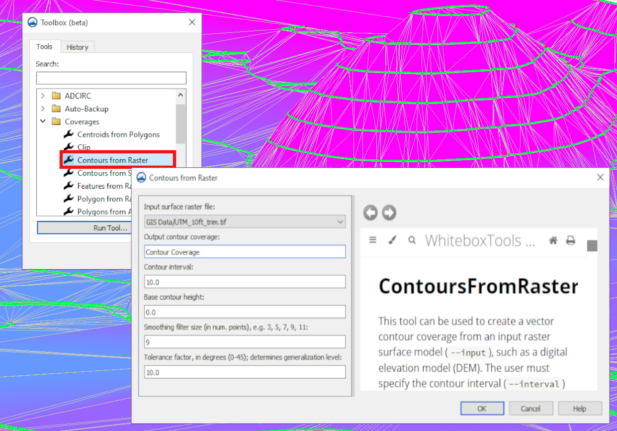
Contours from Raster 工具会从 raster 获取 elevation data,并使用它生成 contour coverage。这会沿指定间隔的 elevations 生成 contour lines。它可以用于多种事项,包括在某些情况下,作为查看项目中应在何处定义 domains 和 boundaries 的一种简单方法。
要使用 Contours from Raster 工具生成该 contour coverage,需要以下组成部分:
- 已加载到项目中的 surface raster file。
- 项目所需的 contour interval。
- 适合项目的 base contour height。
- Smoothing filter size(单位为 num. points),应为奇数。
- 0 到 45 度之间的 tolerance factor。该参数决定 generalization level。
Features from Raster 工具会根据 raster 的 elevation data 生成 features,例如 streams 和 roadway embankments。该工具可以减少手工绘制这些 features 的需要。该工具所需输入为:
- 已加载到项目中的 input elevation raster。
- feature type,可以是 stream 或 ridge。
- threshold area。
- 适合项目的 pre-processing engine:
- rho8:使用 Rho8 算法计算 flow directions 和 accumulations。
- Whitebox full workflow:使用 Whitebox tool full workflow algorithm 计算 flow directions 和 accumulations,该算法使用标准 D8 方法计算 flow directions。
Rasters 通常包含大量数据点,因此在使用 raster 创建 contours 或 features 之前,使用 Smooth Raster 工具或 Feature Preserving Smoothing 工具处理 raster 可能有益。或者,在 coverage 生成后,Clean 功能可用于整理 feature objects。
可以进入任一 XMS 软件,尝试这些新工具,用它们为项目创建 coverages。